Skåne Wald und LandgutGorge & canyonWandern in den Bergen
Söderåsen National Park
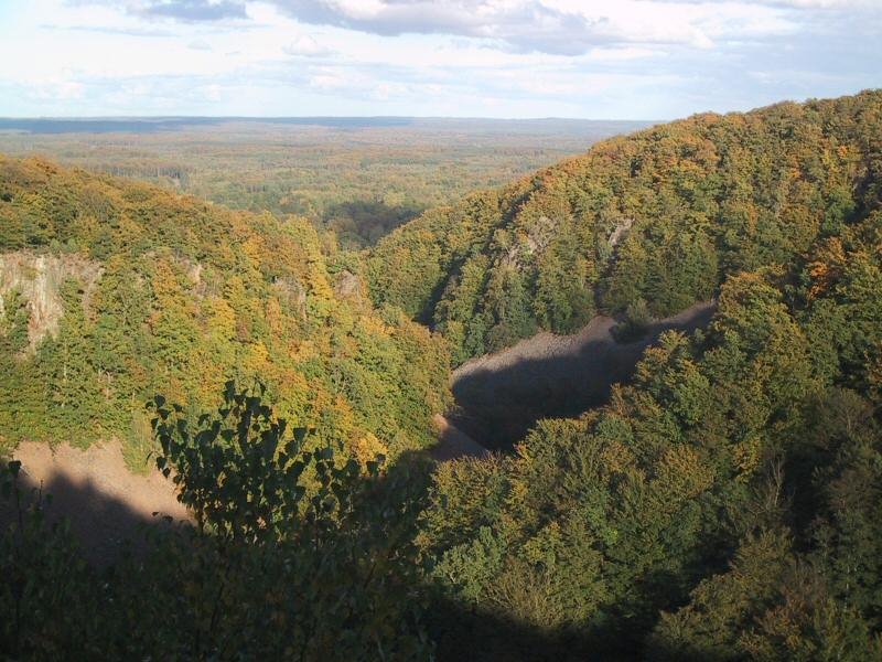
Beech-filled fissure valleys in a farming province
Foto von en:User:Abelson auf Wikimedia Commons
Noch nicht auf Deutsch verfügbar. Angezeigt wird die Fassung auf Englisch.
Über Söderåsen National Park
Söderåsen is an elongated bedrock ridge in Scania, carrying the province’s highest point at 212 metres and cut through by several fissure valleys. It runs from Röstånga in the south-east to Åstorp in the north-west, and Söderåsen National Park lies about 30 kilometres east of Helsingborg. Those fissure valleys are the reason to come: steep-sided, beech-filled ravines wooded with beech, douglas fir, oak and ash, and quite unlike the farmland of the rest of Scania.
Ansehen
Lesen und planen
In der Nähe, über Grenzen hinweg
Im Umkreis von 60 km um diesen Ort, in jedem Land.

Ruhiger in der Nähe
Weitere Orte anderer Art im Umkreis von 60 km.