Alentejo Vestingen en militair erfgoedHistorische stadPrehistorie en archeologie
Monsaraz
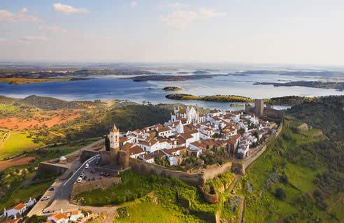
A hilltop village above the Guadiana
Foto door Hurtuv op Wikimedia Commons
Nog niet beschikbaar in het Nederlands. Weergegeven in het Engels.
Over Monsaraz
Monsaraz is a civil parish of the municipality of Reguengos de Monsaraz, standing above the right bank of the Guadiana in the Alentejo close to the Spanish border. The population was 782 in 2011, across 88 square kilometres. The hilltop has been occupied since prehistory, its position making it consequential far beyond its size. Inside the walls it is one long whitewashed street with a castle at the end; outside them, the reservoir below and the surrounding plain make this one of the darkest night skies in Europe.
Kijken
Lezen en plannen
In de buurt, over de grens
Binnen 60 km van deze plek, in elk land.