Highlands & Islands Barrierefreies WandernInsel & InselgruppeUrgeschichte und Archäologie
Callanish Stones
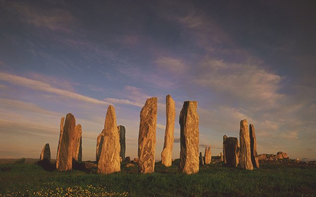
A cross-shaped stone setting from 2750 BC
Foto von Tom Richardson auf Wikimedia Commons
Noch nicht auf Deutsch verfügbar. Angezeigt wird die Fassung auf Englisch.
Über Callanish Stones
A Neolithic stone circle and alignment on a low ridge above Loch Roag, built around 2750 BC: a tall central monolith inside a ring, with rows of standing stones running outward in several directions to make a cross-shaped plan. It is the central site of a wider prehistoric landscape on Lewis, Callanish II, III, IV and VIII lie nearby, together forming what archaeologists call the Calanais complex. The evidence shows ceremonial use continuing for many centuries through the Neolithic and Bronze Age. It is a scheduled monument in the care of Historic Environment Scotland.
Ansehen